West Coast Earthquake Early Warning System Enhanced with Satellite Data
Residents of the West Coast now have an improved earthquake early warning system thanks to the integration of satellite data. This enhancement, announced by the U.S. Geological Survey (USGS) this week, involves the incorporation of GPS data into the ShakeAlert system.
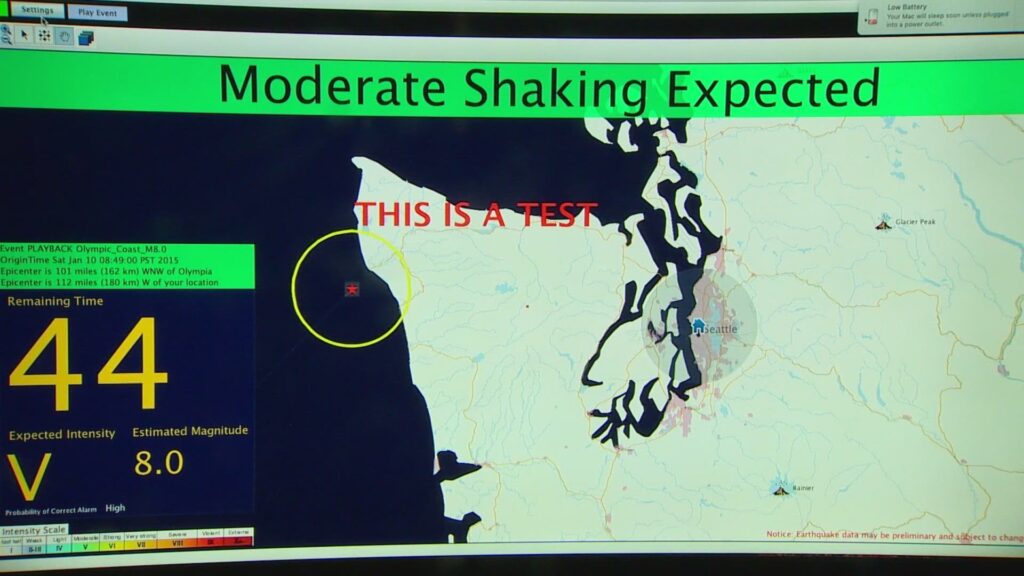
ShakeAlert, which began serving the public in California in late 2019 and expanded to Oregon and Washington in 2021, now includes over 1,500 seismic sensors across these states. The system detects two types of seismic waves radiating from an earthquake’s epicenter. The first wave, which is less intense, activates the early warning sensors.
Individuals can receive alerts on their phones seconds before the strongest shaking starts, giving them crucial moments to seek cover. Beyond personal alerts, ShakeAlert can trigger automated actions such as slowing trains to prevent derailments and opening firehouse doors to avoid jamming.
Robert de Groot, the leader of the USGS ShakeAlert operations team, highlighted the significance of integrating satellite data. He described this development as a major milestone, emphasizing its potential to provide more accurate and faster alerts to those in need. According to de Groot, the addition of GPS data is particularly beneficial for assessing large earthquakes, as it measures ground displacement.
Brendan Crowell, a geophysicist at the University of Washington, played a key role in this advancement. His research, funded by ShakeAlert, led to the creation of the G-FAST algorithm, which is now integral to the system’s GPS component. Crowell explained that while seismic data records accelerations, it does not accurately convey the full magnitude of an earthquake. This limitation, known as magnitude saturation, can cause misestimation of an earthquake’s size. GPS data helps to distinguish between different magnitudes more accurately, enhancing the system’s overall performance.
De Groot noted that with the new GPS data, ShakeAlert can determine an earthquake’s size more quickly and accurately, potentially resulting in earlier alerts for the public. The system continually seeks to reduce latency and incorporate innovative technologies.
There are also plans to expand ShakeAlert beyond its current scope in California, Oregon, and Washington. Potential expansion areas include Alaska and Nevada, as these regions also experience significant seismic activity.